SYMatchedRoad Class Reference

SYMatchedRoad represents road and its position in matched polyline. More...

#import <SYPositioning.h>

Inheritance diagram for SYMatchedRoad:
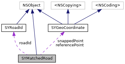
Collaboration diagram for SYMatchedRoad:

Properties

SYRoadIdroadId
 
SYGeoCoordinatereferencePoint
 Coordinate which was taken as an input to matching algorithm. More...
 
SYGeoCoordinatesnappedPoint
 Coordinate located on the road geometry, which is matched from referencePoint Typically it's the closest point on the road. More...
 
SYDistance distance
 Haversine distance between referencePoint and snappedPoint. More...
 
SYDistance distanceFromGeometryStart
 Snapped point distance from road geometry start. More...
 
SYDistance length
 Road length. More...
 

Detailed Description

SYMatchedRoad represents road and its position in matched polyline.

Property Documentation

◆ roadId

- (SYRoadId*) roadId
readnonatomicassign

◆ referencePoint

- (SYGeoCoordinate*) referencePoint
readnonatomicassign

Coordinate which was taken as an input to matching algorithm.

◆ snappedPoint

- (SYGeoCoordinate*) snappedPoint
readnonatomicassign

Coordinate located on the road geometry, which is matched from referencePoint Typically it's the closest point on the road.

◆ distance

- (SYDistance) distance
readnonatomicassign

Haversine distance between referencePoint and snappedPoint.

◆ distanceFromGeometryStart

- (SYDistance) distanceFromGeometryStart
readnonatomicassign

Snapped point distance from road geometry start.

◆ length

- (SYDistance) length
readnonatomicassign

Road length.


The documentation for this class was generated from the following file: