#import <SYNavigationStreetInfo.h>
|
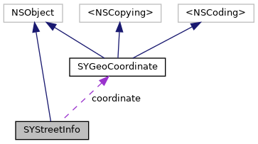
| SYGeoCoordinate * | coordinate |
| | The geographical location of the position. More...
|
| |
| SYCountryIso * | country |
| | Country iso code of the country where the current position is. More...
|
| |
| NSString * | city |
| | Represents the city where the current position is. More...
|
| |
| NSArray< NSString * > * | roadNumbers |
| | Represents the road numbers where the current position is. Number are sorted from most. More...
|
| |
| NSString * | area |
| | Represents the area where the current position is. More...
|
| |
| NSString * | street |
| | Represents the street where the current position is. More...
|
| |
| NSString * | numberLeft |
| | Represents the left number where the current position is. More...
|
| |
| NSString * | numberRight |
| | Represents the right number where the current position is. More...
|
| |
| SYRoadType | roadType |
| | Represents the road class type of road where the current position is. More...
|
| |
| BOOL | isUrban |
| | Indicates whether road is located in city. More...
|
| |
◆ coordinate
The geographical location of the position.
◆ country
| - (SYCountryIso*) country |
|
readnonatomicassign |
Country iso code of the country where the current position is.
◆ city
Represents the city where the current position is.
◆ roadNumbers
| - (NSArray<NSString*>*) roadNumbers |
|
readnonatomicassign |
Represents the road numbers where the current position is. Number are sorted from most.
◆ area
Represents the area where the current position is.
◆ street
Represents the street where the current position is.
◆ numberLeft
Represents the left number where the current position is.
◆ numberRight
| - (NSString*) numberRight |
|
readnonatomicassign |
Represents the right number where the current position is.
◆ roadType
Represents the road class type of road where the current position is.
◆ isUrban
Indicates whether road is located in city.
The documentation for this class was generated from the following file:
 1.8.17